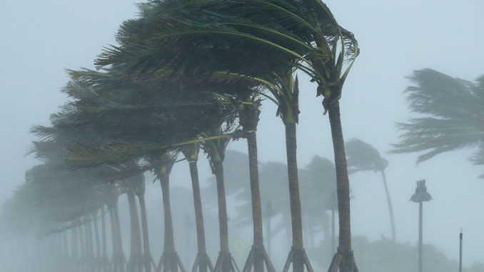
On Tuesday’s National Hurricane Center discussion # 14 10:00pm update Air Force Reserve and NOAA Hurricane Hunter aircraft predict that Michael will make landfall “along the coast of the central panhandle of Florida by late Wednesday afternoon.”
The eye had become more distinct, “with a solid ring of cloud top temperatures colder than -75 deg C surrounding the warming eye” with some “cloud tops in the eyewall” as cold as -88 deg C “which is very impressive for a Gulf system.” Winds have been measured at peak so far at 130-kt and surface winds have been measured at 110-kt.
According to NOAA’s National Weather Service as of 10: 36 pm CTD Hurricane Michael is now “explicitly” forecast to become a Cat 4 before landfall, which means sustained winds will be 130 mph or higher.
Oct 09 2018
Oct 09 2018
After landfall, increasing southwesterly flow ahead of the approaching deep-layer trough is expected to accelerate Michael toward the northeast through 48 h, with the cyclone moving across the southeastern U.S. late Wednesday and Thursday, and emerging over the western Atlantic by early Friday. A continued northeastward motion at forward speeds of 30-40 kt is forecast at 72-120 h when Michael is expected to be an extratropical cyclone.
National Hurricane Center; 1000 PM CDT Tue Oct 09 2018
CNN’s Hurricane Watch reported Tuesday evening Michael is now a Cat 3 storm with sustained winds at 120 mph with gusts up to 150 mph. As the Hurricane continues to undergo more rapid intensification – defined as an increase of sustained winds of 35 mph in a 24-hour period – over the next 12 to 18 hours and reaches Category 4, expectations are it will make landfall as a Cat 1 or possibly Cat 2, which would make Michael “the strongest storm in terms of wind speed to make landfall in the country this year.”
Florida Governor Rick Scott told residents if they are in the evacuation areas, “You cannot hide from the storm surge, so get out if an evacuation is ordered.”
Tropical force winds “will be felt in the area starting early Wednesday,” and Scott has issued both mandatory and voluntary evacuations orders for 22 counties on the western Gulf Coast of Florida.
About 3.7 million people were under hurricane warnings in the Panhandle and Big Bend regions, as well as parts of southeastern Alabama and southern Georgia. Tropical storm warnings cover 8.5 million people in four states.
CNN; Tue Oct 09 2108
For NHC’s Public Advisories for Watches and Warning here.
NOAA’s National Weather Service Twitter here.
President Trump Approves Florida Emergency Declaration.
On A Side Note
I’ll bring updates throughout the day as we watch this crazy one. If we have anyone in the area keep us updated on how you’re doing. Be safe.

1 Trackback / Pingback
Comments are closed.