

The latest forecast from the National Hurricane Center (NHC) predicts the eye of Florence will likely make landfall somewhere along the coast of the Carolinas, probably Thursday night or Friday morning.
The governors of both North Carolina and South Carolina have declared a state of emergency.
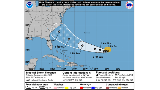
As of Saturday, September 8, Florence was classified as a tropical storm, with winds of 39 to 73 mph. Florence is expected to strengthen on Sunday into a hurricane with winds above 73 mph. Sometime on Monday, Florence will be upgraded to a major hurricane with winds in excess of 110 mph and maintain that power until landfall either Thursday or Friday.
To get the most up to date information on Florence, including wind speed, arrival time, wind history, cone maps, surface winds, key messages, and warnings, please visit the NHC Florence page.
The NHC also publishes an advisory on Florence.
Accuweather.com has provided tips to protect your home from the storm. These include; protecting your windows (hint: taping them is a bad idea), preparing for flooding, securing anything that’s not already fastened down, unplugging appliances you don’t need, and performing an inventory of your property and belongings in case of loss. All sound advice.