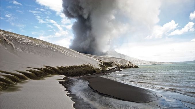
Most people don’t really want to live with a volcano, let alone inside the caldera, especially one that has erupted and destroyed their town twice in the last century.
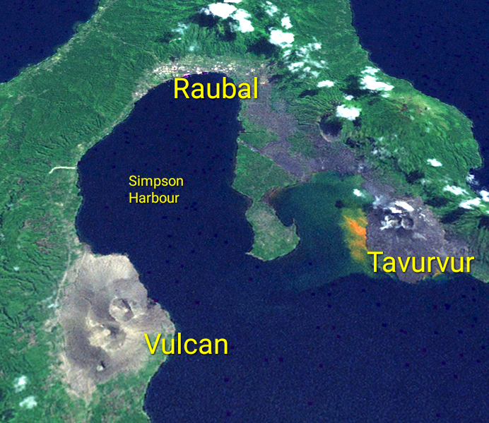
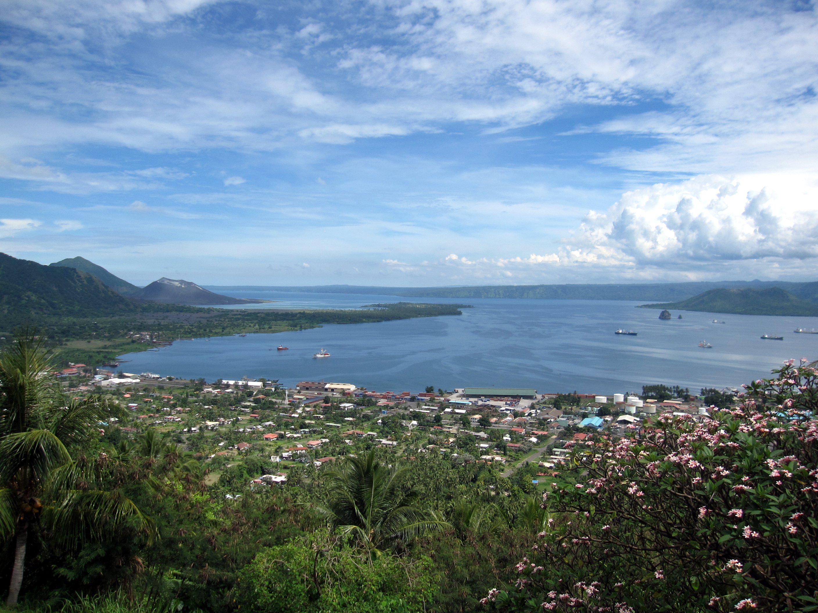
At the northern end of the island of New Britain, which is part of Papua New Guinea, lies the town of Rabaul (4°11′53″S, 152°10′7″E). The feature that makes Rabaul valuable is Simpson Harbour, one of the best in the South Pacific. The harbor entrance is flanked by two cone-shaped volcanic vents known as Tavurvur and Vulcan.

The earliest known eruption occurred about 535 AD. A second, more massive eruption in approximately 683 AD formed the huge caldera and Simpson Harbour. The rim of the caldera encircles the harbor, except on the southeast side where it is open to the Pacific. In other words, the entire harbor is sitting on top of an active volcano.
In 1878, not long before Rabaul was established, the volcano erupted on the south rim. This vent created the double cone now known as Vulcan, leaving little doubt that this was a dicey location for a settlement. The exceptional harbor proved to be an irresistible draw, however.
New Guinea was a German colony from 1884 until after the end of the First World War. The first settlement on the shores of the harbor, and inside the rim of the caldera, was originally named Simpsonhafen (German for Simpson Harbour). The colonial government in 1910 made the decision to relocate there, no doubt due to the advantages the harbor offered. They renamed the town Rabaul, which in the native language of Kuanua means mangrove. Apparently a mangrove swamp had existed on the site before it yielded space for Simpsonhafen, then disappeared entirely as Rabaul grew.
Not long after First World War hostilities began, Rabaul and Simpson Harbour were captured by the Australians, who recognized the strategic value of the port. After the war, New Guinea was transferred to Australia by League of Nations Mandate, effective 1920. The Australian government made Rabaul the capital of the Territory of New Guinea and an important military base in the region.
In 1937 both major vents, Tavurvur and Vulcan, erupted violently resulting in the deaths of over 500 people and the destruction of Rabaul. As a result the seat of the territorial government was relocated to Lae, which was just as well. At the beginning of the Second World War, the Japanese also recognized the strategic value of the harbor and base. In January 1942, Imperial Japanese forces attacked and seized Rabaul, which became their stronghold in the South Pacific. They improved the defenses of the base and harbor to such an extent that the Allies decided to skip by it during the Pacific island-hopping campaign. Instead, the Allies established a ring of bases around Rabaul from which to harass and contain Japanese forces, effectively rendering the base useless to the Japanese.
In September 1994, another major eruption took place again destroying the town and its commercial airport. (The old airport was located directly between Tavurvur and the old town, now covered in gray lava ash as seen in the satellite image). Fortunately, thanks to early warning provided by the Volcanology Observatory and evacuation drills, only five people lost their lives.

The older part of Rabaul, which is closest to Tavurvu and known as ‘old town’ was never rebuilt. The ‘new town’ carries on, despite frequent ash plumes from the volcanic vents.

Question of the night: What’s the worst potential natural disaster you’re willing to live with?

1 Trackback / Pingback
Comments are closed.